Capitol Reef National Park Scenic Drive: Everything You Need to Know
Planning to drive Capitol Reef National Park's Scenic Drive? Here's what to know about the 7.9-mile route, best stops, entrance fees, road conditions, and why sunset is my favorite time to visit.


All photographs are © Roaming the Southwest unless stated otherwise. Unauthorized reproduction or use is prohibited.
If you only have a few hours in Capitol Reef National Park, the Scenic Drive is one of the best ways to experience the park without committing to a long hike. This 7.9-mile paved road follows the Waterpocket Fold, with access to Grand Wash, Capitol Gorge, and some of my favorite views in the park.
I especially love driving and photographing the Scenic Drive around sunset, when the sandstone cliffs catch the evening light. It's one of my favorite places in Capitol Reef to photograph, and I recommend allowing extra time for stops rather than rushing through.
In this Capitol Reef National Park Scenic Drive guide, I'll cover where the drive starts, how long it takes, the best stops, entrance fees, road conditions, and what to know before you go.
What Is the Capitol Reef National Park Scenic Drive?
The Capitol Reef Scenic Drive is a 7.9-mile paved road that begins near the visitor center in the Fruita District and travels south along the western side of the Waterpocket Fold.
Unlike some of Utah's other scenic drives, this isn't a loop. You'll drive south to the end of the pavement and return the same way, making the paved portion approximately 15.8 miles round-trip.
The route passes towering sandstone cliffs, colorful rock layers, and plenty of places to pull over for photographs. It also provides access to some of the park's most popular hikes and attractions, including Grand Wash, Cassidy Arch, the Tanks, Pioneer Register, and Capitol Gorge.
One thing worth clarifying: this is different from the remote Cathedral Valley, Notom-Bullfrog, and Burr Trail drives. You don't need a high-clearance vehicle to drive the paved Scenic Drive, making it an easy option for most visitors.
Where Does the Capitol Reef Scenic Drive Start?
The Scenic Drive begins near the Capitol Reef National Park Visitor Center, just south of Highway 24 in the Fruita District.
From Torrey, drive east on Highway 24 toward the park. The visitor center is approximately 11 miles from town.
Scenic Drive Starting Point: 38.291319, -111.261681 | Google Maps Directions
The first part of the route passes through historic Fruita, including the orchards and Gifford Homestead. Continue south past the campground to reach the Scenic Drive entrance fee station.
I'll be honest, in the 15+ times I've driven this road, I've never once seen anyone collecting fees at the entrance station. That said, the entrance fee still applies, so please stop at the Visitor Center to pay or make sure your America the Beautiful Pass is displayed on your dashboard. Our national parks need all the funding they can get!
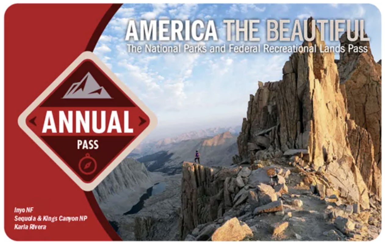
Important: Highway 24 passes through Capitol Reef without an entrance fee. The Scenic Drive is a separate fee area.
I recommend stopping at the visitor center before starting your drive, especially if you're planning to explore Grand Wash or Capitol Gorge. You can check road conditions, use the restrooms, and pick up a park map.
Capitol Reef Scenic Drive Map: Route, Stops & Attractions
Use the interactive map below to explore the Capitol Reef Scenic Drive, including the route, hiking trailheads, photography stops, and nearby attractions.
How Long Does the Capitol Reef Scenic Drive Take?
The National Park Service recommends approximately 1.5 hours to drive the Scenic Drive and its two main dirt spur roads.
However, how long you'll need depends on whether you're stopping for photographs or adding hikes.
Personally, I'd allow at least two hours if you're visiting for photography.
The drive isn't particularly long, but I find myself stopping frequently, especially when the evening light starts hitting the cliffs.
Best Stops Along the Capitol Reef Scenic Drive
There aren't many developed overlooks along the Scenic Drive, but there are plenty of places worth stopping. Some of my favorite photographs have come from simply pulling over along the route.
Here are the stops I'd prioritize.
1. Fruita Historic District
Near the beginning of the Scenic Drive, you'll pass the historic Fruita orchards, Gifford Homestead, and campground. This is also where you'll find the Cohab Canyon Trailhead, one of my favorite hikes in the area, with incredible views overlooking the orchards.
I especially love Fruita in the fall when the cottonwoods turn yellow against the red cliffs.
My tip: Get to Gifford Homestead early and snag a few of their famous fruit pies before they sell out. Leave them in your car while you hike and explore, then come back to enjoy some pie afterward! Just avoid leaving them on a hot dashboard, especially during summer.
2. Grand Wash Road
This 1.3-mile unpaved spur road leads into a canyon surrounded by towering sandstone walls and provides access to two popular hikes:
- Grand Wash Trail: An easy canyon walk with increasingly narrow sections. You don't have to hike the entire trail to enjoy it.
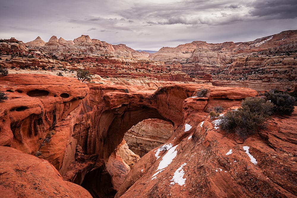
- Cassidy Arch Trail: A more strenuous hike to one of Capitol Reef's most recognizable arches. Allow several additional hours.
The road is generally accessible to passenger cars in dry conditions but can become impassable after rain.
3. Scenic Drive Viewpoints and Pullouts
Some of my favorite photography spots aren't named overlooks. They're simply pullouts along the Scenic Drive with views of the colorful sandstone cliffs and Waterpocket Fold.
I recommend taking your time in both directions since the views and lighting change depending on where you're facing. Late afternoon is especially beautiful when the cliffs catch the evening light.
Always use established pullouts rather than stopping in the roadway.
4. Capitol Gorge Road
At the end of the paved Scenic Drive, this 2.4-mile unpaved road winds through a narrow canyon to the Capitol Gorge trailhead.
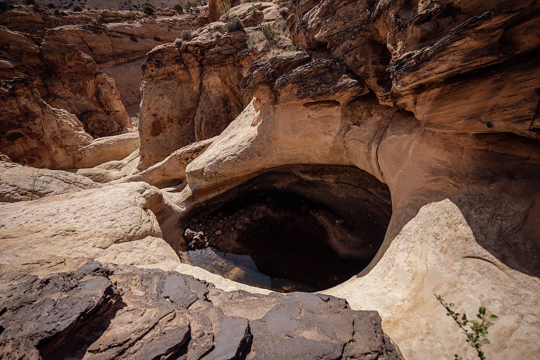
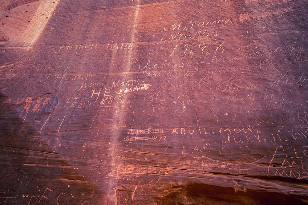
From here, you can walk to the Pioneer Register, where early travelers carved their names into the canyon walls, or continue to the Tanks, a series of natural water pockets reached by a steeper side trail. The Pioneer Register is really cool to see if you can make the easy hike.
Even without hiking, the drive through the canyon is worth it when conditions allow.
Important: Capitol Gorge is prone to flash flooding. Avoid the road when rain or thunderstorms are possible, including storms upstream.
5. Pleasant Creek Road
This unpaved road continues approximately 2.8 miles south from the end of the Scenic Drive to the Pleasant Creek trailhead.
It's a less-developed option with variable road conditions, and the route becomes substantially rougher beyond Pleasant Creek.
Unless you're specifically planning to explore this area, I'd prioritize Grand Wash and Capitol Gorge instead.
Best Time to Drive the Capitol Reef Scenic Drive
You can enjoy the Scenic Drive any time of day, but late afternoon and sunset are my favorite times, especially for photography. The sandstone cliffs catch the evening light, and I love watching the colors change as the sun gets lower.
If you're planning to hike Grand Wash, Cassidy Arch, or Capitol Gorge, morning is a better option during warmer months before temperatures climb. Midday is fine for sightseeing, but the lighting tends to be harsher for photography.
My recommendation: Drive the route before sunset to scout a few photo locations, then stop at your favorites on the way back as the light changes. Just allow enough daylight if you're planning to explore the unpaved spur roads.
Do You Need a 4WD Vehicle for the Capitol Reef Scenic Drive?
No. The main 7.9-mile Scenic Drive is paved and accessible to standard passenger vehicles.
Grand Wash and Capitol Gorge Roads are unpaved but generally accessible to passenger cars in dry conditions. However, rain, snow, ice, and flash flooding can make these roads impassable.
If you're driving a rental car, check your agreement before traveling on unpaved roads. Larger RVs should also check for restrictions.
Always check the National Park Service road conditions before visiting.
Other Scenic Stops Near Capitol Reef's Scenic Drive
If you have extra time, there are several stops along Highway 24 worth adding to your visit. These aren't directly along the Scenic Drive, but they're easy to combine with it.
- Panorama Point: A short drive off Highway 24 with sweeping views of Capitol Reef's colorful landscape and very little walking required.
- Goosenecks Overlook: A short trail near Panorama Point overlooking Sulphur Creek Canyon.
- Hickman Bridge: A 1.8-mile round-trip hike to a massive natural sandstone bridge. I especially love this area in the fall when the cottonwoods along the Fremont River turn yellow.
- Capitol Reef Petroglyph Panels: An easy boardwalk stop along Highway 24 where you can see ancient rock art left by the Fremont culture.
For more hikes, photography locations, and things to do, check out my Capitol Reef National Park Travel Guide.
What to Know Before Driving the Scenic Drive
- Check road conditions. Grand Wash and Capitol Gorge can close because of flooding, mud, snow, or ice.
- Bring water. Services are limited beyond the Fruita area, and summer temperatures can be extremely hot.
- Download offline maps. Cell service is unreliable in parts of Capitol Reef. I don't have any service in the Fruita district with AT&T.
- Use designated pullouts. Don't stop in the road for photographs.
- Watch the weather. Flash floods are a serious concern in narrow canyons and washes. The scenic drive crosses multiple washes that can flood.
- Allow extra time for hikes. Cassidy Arch and the longer canyon trails can easily add several hours to your visit.
Capitol Reef Scenic Drive FAQs
How long does the Capitol Reef Scenic Drive take?
Allow 60–90 minutes to drive the paved route with a few quick stops. If you're planning to explore Grand Wash, Capitol Gorge, or stop frequently for photography, I'd recommend at least 2–3 hours.
Is the Capitol Reef Scenic Drive worth it?
Absolutely! It's one of the easiest ways to experience Capitol Reef without committing to a long hike. I've driven it more than 15 times, and it's still one of my favorite places in the park to photograph, especially around sunset.
What are the best Capitol Reef Scenic Drive stops?
I'd prioritize Grand Wash, Capitol Gorge, and the photography pullouts along the paved road. If you have extra time, Panorama Point, Fruita Schoolhouse, Fremont Petroglyphs, and Hickman Bridge are all worthwhile additions along nearby Highway 24.
Do you need a special vehicle for the Capitol Reef Scenic Drive?
No. The main Scenic Drive is paved and accessible to standard passenger vehicles. Grand Wash and Capitol Gorge Roads are unpaved but generally accessible in dry conditions. Always check road conditions before visiting.
Plan Your Capitol Reef National Park Trip
The Scenic Drive is only one small part of Capitol Reef National Park. If you have more time, I highly recommend exploring the park's hiking trails and some of the more remote areas along the Waterpocket Fold.
My Capitol Reef National Park Travel Guide covers the best things to do, hikes, photography locations, where to stay, and practical tips for planning your visit.
You can also explore my National Parks travel guides if you're visiting more of Utah's Mighty Five.