Chiricahua National Park Travel Guide: Best Things to Do, Hikes & Tips
Planning a trip to Chiricahua National Park, America's 64th national park? Here's what to know about the best hikes, scenic drive, rock formations, and tips for visiting this incredible corner of southeastern Arizona.


All photographs are © Roaming the Southwest unless stated otherwise. Unauthorized reproduction or use is prohibited.
Chiricahua National Park in southeastern Arizona is officially America's 64th national park! Formerly Chiricahua National Monument, the park is known for its towering rock pinnacles, balanced rocks, and some of the most unusual landscapes in the Southwest.
What makes Chiricahua different from many other national parks is how much you can experience in a relatively small area. You can drive Bonita Canyon Scenic Drive, stop at overlooks, explore historic Faraway Ranch, or hike directly into the rock formations.
Some of my favorite experiences here include hiking Echo Canyon to the Grottoes, exploring the Heart of Rocks Loop, and photographing the Organ Pipe Formation along the scenic drive.
In this Chiricahua National Park travel guide, I'll cover the best things to do, hikes, scenic drive, where to stay, and practical tips for planning your visit.
Chiricahua National Park Overview
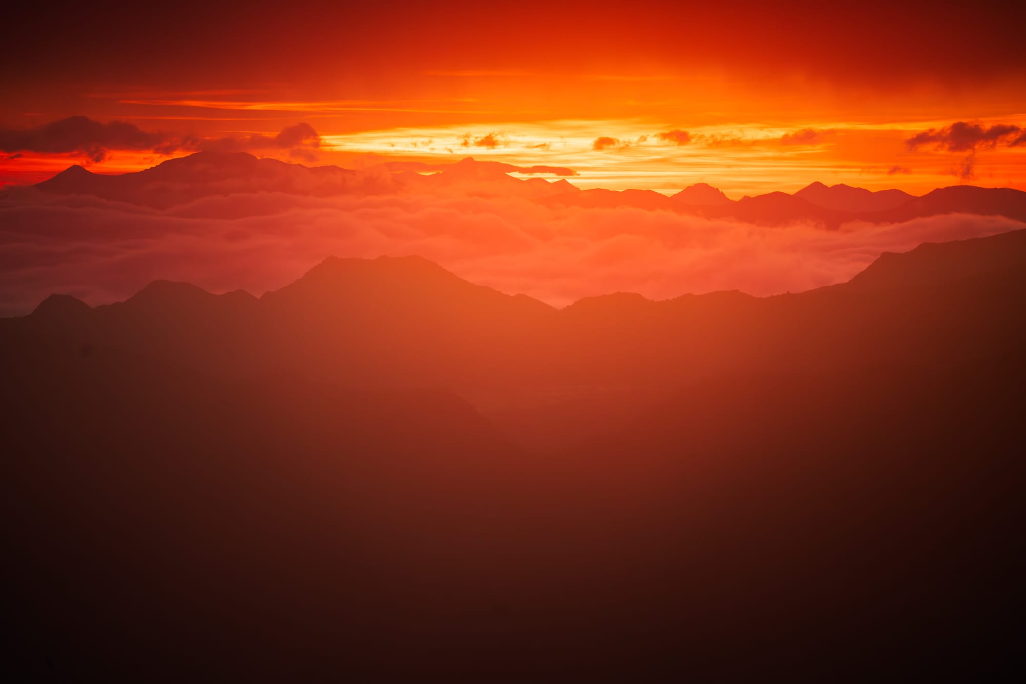
Where Is Chiricahua National Park & How Do You Get There?
Chiricahua National Park is located in southeastern Arizona, approximately 36 miles southeast of Willcox, near the New Mexico border.
The park protects part of the Chiricahua Mountains, one of southeastern Arizona's sky islands. These isolated mountain ranges rise above the surrounding desert, creating cooler temperatures and habitats that are very different from the lower elevations.
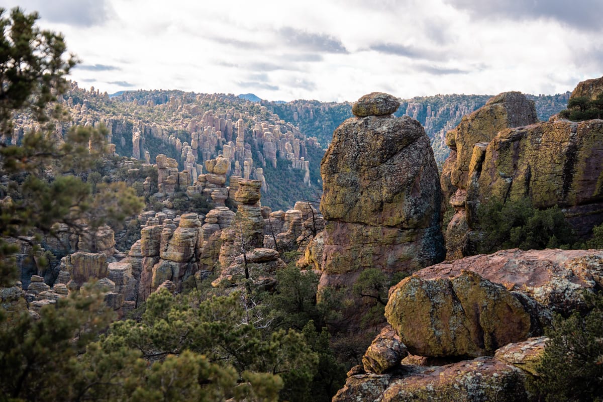
The rock formations Chiricahua is famous for were created by a massive volcanic eruption approximately 27 million years ago. Over time, erosion shaped the volcanic rock into the pinnacles and balanced formations you see today.
You'll need your own vehicle to explore Chiricahua. From Willcox, follow Arizona Highway 186 south, then Highway 181 to the park entrance.
There's only one paved entrance into the park. Bonita Canyon Scenic Drive ends at Massai Point, so you cannot drive through the park to reach the eastern side of the Chiricahua Mountains.
Fuel up before arriving. There are no gas stations inside the park, and cell service is limited.
Best Airports for Visiting Chiricahua National Park
Tucson International Airport is the closest major commercial airport to Chiricahua National Park. Phoenix has considerably more flight options, while El Paso may work if you're combining Chiricahua with destinations in southern New Mexico.
Driving Distances to Chiricahua National Park from Nearby Cities
Willcox is the most convenient place to stay if you're planning to spend a full day hiking or want to reach the park early.
Driving Distances from Chiricahua to Other National Parks & Monuments
Chiricahua is a great addition to a longer Arizona or Southwest road trip, especially if you're visiting Saguaro National Park. White Sands and several other national park sites in southern Arizona and New Mexico are also within driving distance.
Distances and times are approximate, measured to the Chiricahua park entrance or main visitor area. Actual travel times vary by route and road conditions.
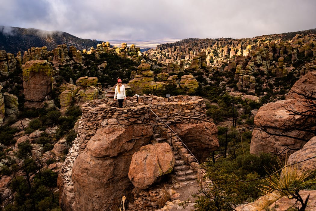
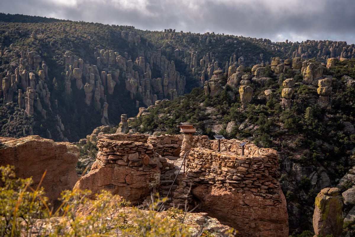
Speaker Rock near Massai Point in Chiricahua National Park. © Roaming the Southwest
Chiricahua National Park History: The Chiricahua Apache
Long before Chiricahua became a national monument or national park, this region was part of the ancestral homeland of the Chiricahua Apache.
The Chiricahua Mountains and surrounding valleys were important to Apache communities who moved seasonally between the mountains and lower desert, hunting, gathering, and living throughout the region.
The area is associated with Apache leaders including Cochise and Geronimo, who resisted the forced removal of their people during the Apache Wars in the 1800s.
Following years of conflict, the U.S. government forcibly removed the Chiricahua Apache from their homeland. In 1886, many were transported as prisoners of war to Florida, including families who had not participated in the fighting. Their displacement continued for decades.
This history is an important part of understanding Chiricahua. The landscape wasn't an empty wilderness waiting to be discovered. It was home to Indigenous communities long before the establishment of the national park.
The National Park Service provides additional information about the history of the Chiricahua Apache and the Apache Wars.
Chiricahua National Park Entrance Fees & Reservations
Chiricahua currently has no entrance fee, and timed-entry reservations are not required.
The park was officially redesignated on October 20, 2026, so I recommend checking the National Park Service website for any changes to entrance fees or visitor requirements. This article will be updated when/if that changes.
Important: Bonita Canyon Campground requires reservations, even though you don't need a reservation to enter the park.
Best Time to Visit Chiricahua National Park
Spring and fall are generally the best times to visit Chiricahua, especially if you're planning longer hikes. I visited in the winter though and the weather was so pleasant.
Spring (March–May)
Spring brings comfortable hiking temperatures and opportunities to see wildflowers. It's a great time to explore Echo Canyon and Heart of Rocks before summer temperatures arrive.
Summer (June–August)
Summer can be hot, although Chiricahua's higher elevations are often cooler than Tucson and Phoenix.
Afternoon thunderstorms are common during the summer monsoon season, so I'd plan longer hikes early in the morning and keep an eye on the weather.
Fall (September–November)
Fall is another excellent time to visit, with generally more comfortable hiking temperatures and fewer concerns about summer heat.
If you're planning to spend a full day exploring the trails, this is one of the seasons I'd prioritize.
Winter (December–February)
Winter can be beautiful, but don't assume southeastern Arizona means warm weather. Chiricahua reaches elevations above 7,000 feet, and snow and ice can affect the scenic drive and hiking trails.
Check current conditions before heading into the park.
Best Things to Do in Chiricahua National Park
You don't have to complete a long hike to enjoy Chiricahua, but some of the most interesting rock formations are reached on foot.
These are the experiences I'd prioritize.
1. Drive Bonita Canyon Scenic Drive
Bonita Canyon Scenic Drive is one of the best ways to experience Chiricahua National Park, especially if you have limited time.
The approximately 8-mile paved road climbs through Bonita Canyon, passing historic sites, forested areas, and towering volcanic rock formations before ending at Massai Point.
One of my favorite things about this drive is how much the scenery changes as you gain elevation.
I'd allow at least an hour for the drive, but longer if you're planning to stop for photographs or short walks.
2. Visit Massai Point & Speaker Rock
Massai Point sits at the end of Bonita Canyon Scenic Drive and offers some of the best panoramic views in Chiricahua National Park.
From the overlook, you can see thousands of volcanic rock pinnacles stretching across the surrounding canyons, with distant mountain ranges beyond.
Don't miss Speaker Rock, located near the Massai Point parking area. It's an easy stop to see another of the park's unusual rock formations without committing to a longer hike.
You can also walk the short Massai Point Nature Trail for additional viewpoints and a closer look at the formations.
3. Visit Faraway Ranch
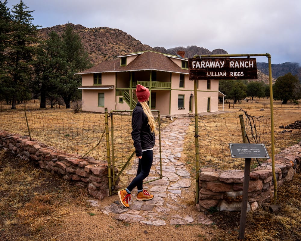
Faraway Ranch is one of the park's most interesting historic sites and worth stopping at as you drive through Bonita Canyon.
The ranch was established by Swedish immigrants Emma and Neil Erickson in the late 1800s and later operated as a guest ranch by members of their family.
Today, you can explore the historic district and learn about the families who lived here and helped introduce visitors to the area's rock formations.
Check with the visitor center about current access and any ranger-led tours. The ranch house itself isn't generally open for unrestricted entry.
4. See the Organ Pipe Formation
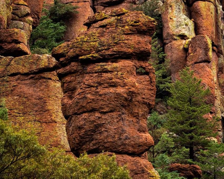
One of my favorite rock formations along Bonita Canyon Scenic Drive is the Organ Pipe Formation.
The tall, narrow columns of volcanic rock resemble the pipes of a massive organ and are especially impressive when you see them rising above the road.
You don't need to hike to see them, making this an easy stop to include while driving through the park.
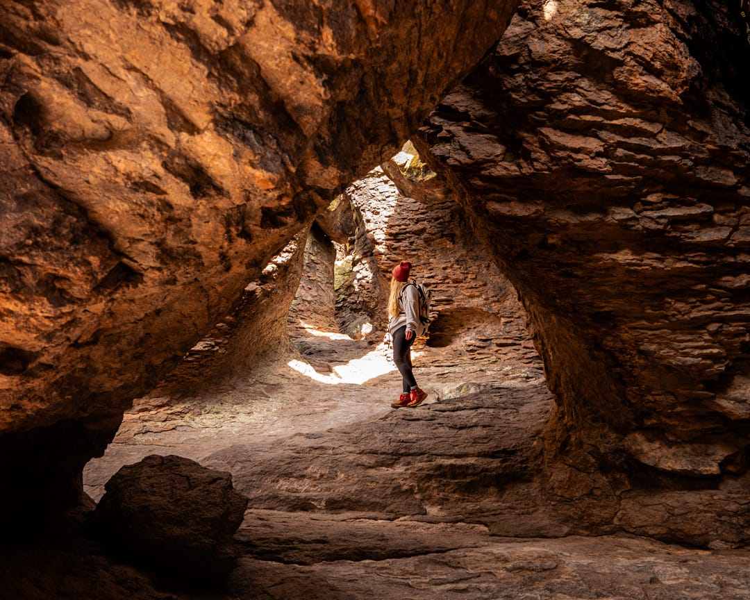
5. Hike Echo Canyon Trail to the Grottoes
If you're only planning one short hike in Chiricahua, Echo Canyon to the Grottoes would be my recommendation.
The trail passes between towering rock formations and leads to the Grottoes, a series of narrow, tunnel-like passages through the volcanic rock.
You'll also pass some incredible formations along the way, including Tulip Rock.
The Grottoes are approximately half a mile from the Echo Canyon trailhead, making this about a 1-mile round-trip hike.
You can also continue on the full Echo Canyon Loop if you have more time.
6. Hike the Heart of Rocks Loop
Heart of Rocks is one of the best hikes in Chiricahua if you want to explore more of the park's unusual formations.
The route takes you past named formations including Big Balanced Rock, Pinnacle Balanced Rock, and Duck on a Rock.
Unlike Echo Canyon to the Grottoes, this is a longer, more strenuous hike with significant elevation changes and plenty of rock steps.
Allow most of the day, especially if you're stopping frequently for photographs.
7. Keep an Eye Out for Coatis
Chiricahua is one of the few places in the United States where you might spot a coati, also called a coatimundi.
These relatives of raccoons have long, ringed tails and narrow snouts and are often seen foraging along the ground. They sometimes travel in groups, so if you spot one, keep an eye out for others nearby.
Watch for them along Bonita Canyon Scenic Drive and around the park's lower elevations. As with all wildlife, keep your distance and never feed them.
8. Look out for Sea Captain Rock
As you're driving Bonita Canyon Scenic Drive, keep an eye out for Sea Captain Rock, one of Chiricahua's uniquely shaped rock formations.
With a little imagination, you can make out the profile of a sea captain in the volcanic rock. It's one of those formations that's easy to miss if you don't know to look for it, so keep your eyes peeled as you make your way through the canyon. If you're heading to Massai Point from the entrance, it will be on your right just after the Organ Pipes.
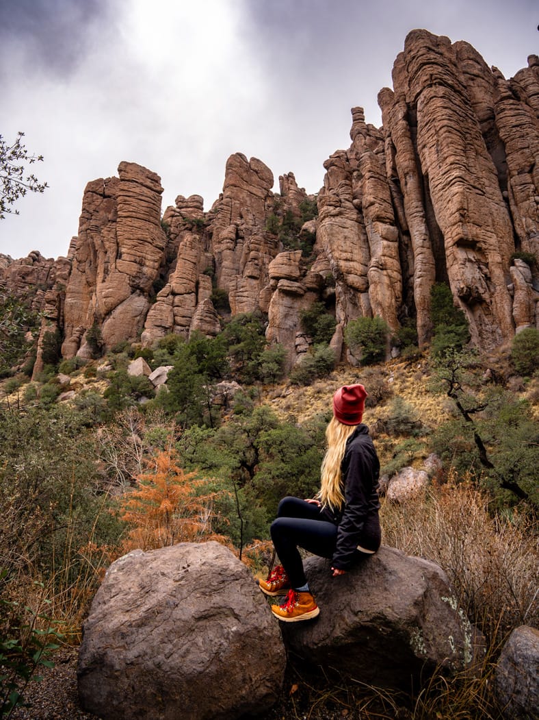
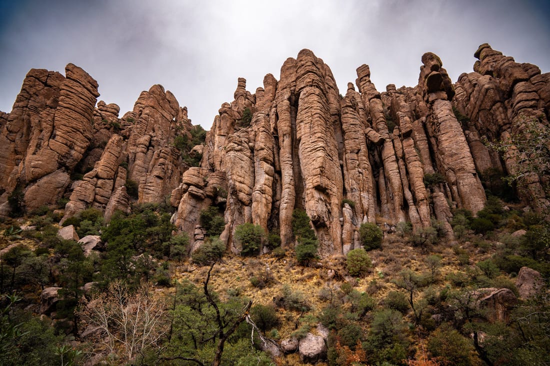
The Organ Pipe rock formation along Bonita Canyon Scenic Drive in Chiricahua National Park. © Roaming the Southwest
Best Hikes in Chiricahua National Park
Chiricahua has hiking options ranging from short walks to strenuous routes that require several hours.
I've organized these by difficulty rather than distance to make it easier to decide which hikes are right for your visit.
Distances and hiking times are approximate. Trail conditions, elevation, and your chosen route can affect difficulty.
Easy Hikes
Massai Point Nature Trail: A short loop at the end of the scenic drive with views of the surrounding rock formations. Great if you want to experience the upper elevations without committing to a longer hike. Be sure to look for Speaker Rock, it's on the opposite side of the parking area from Massai Point.
Silver Spur Meadow Trail: An easy walk connecting several historic areas of the park, including Faraway Ranch and the visitor center area.
Moderate Hikes
Echo Canyon to the Grottoes: One of my favorite short hikes in the park. The rock formations are incredible, and you don't have to hike far to reach them. There are uneven steps and loose rocks, so it isn't completely effortless.
Echo Canyon Loop: If you have more time, continue beyond the Grottoes and complete the 3.3-mile loop using the Echo Canyon, Hailstone, and Ed Riggs trails.
Strenuous Hikes
Heart of Rocks Loop: My recommendation for hikers who want to spend more time exploring Chiricahua's rock formations. Although the named loop itself is shorter, the approach trails make this a roughly 7.3–7.5-mile outing.
The Big Loop: A 9.5-mile hike combining several of Chiricahua's best trails, including Echo Canyon and Heart of Rocks. I'd only recommend this if you have a full day and are comfortable with longer, strenuous hikes.
For current trail conditions and detailed route maps, see the official Chiricahua hiking guide.
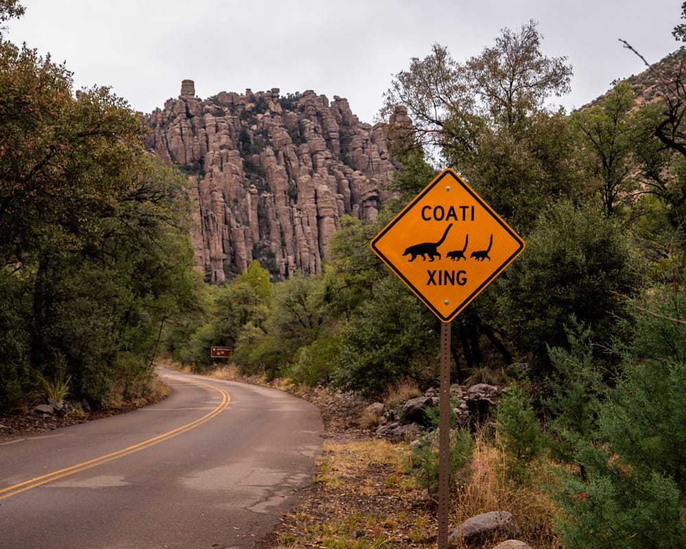
Bonita Canyon Scenic Drive
Distance: Approximately 8 miles one-way
Time needed: 1–2 hours with stops, longer if hiking
Vehicle: Standard passenger car
Route: Paved, out-and-back
Bonita Canyon Scenic Drive is the main road through Chiricahua National Park, beginning near the park entrance and climbing to Massai Point.
Along the way, you'll pass Faraway Ranch, the visitor center, Organ Pipe Formation, and several overlooks before reaching the upper trailheads.
I'd recommend driving all the way to Massai Point and taking your time on the return. Several of the pullouts are easier to access when traveling downhill.
Important: This isn't a through-road. You'll return the same way you entered the park.
Chiricahua National Park Photography Tips
Chiricahua is a fantastic place to photograph, especially if you enjoy unusual rock formations and landscapes that look different from the rest of Arizona.
These are the locations I'd prioritize:
- Organ Pipe Formation: One of my favorite formations to photograph along Bonita Canyon Scenic Drive. You can photograph the towering columns right at a pull out.
- Echo Canyon and the Grottoes: The rock formations, narrow passages, and Tulip Rock provide plenty of opportunities for interesting compositions. This is my favorite trail in the park.
- Heart of Rocks: One of the best areas for photographing Chiricahua's balanced rocks and named formations, although reaching them requires a longer hike so plan for 4-6 hours for this one.
- Massai Point: An easy option for wide views across the surrounding rock formations and Chiricahua Mountains. It's great for sunrise and gives such a high and incredible vantage across the valley.
My photography tip: Don't limit yourself to the overlooks. Some of the most interesting compositions are along the trails, where you can photograph the formations from below and use the narrow passages to frame your shots.
Chiricahua National Park Itineraries
Half-Day Chiricahua National Park Itinerary
If you only have a few hours, I'd focus on the scenic drive and one short hike.
- Stop at the visitor center.
- Visit Faraway Ranch Historic District.
- Drive Bonita Canyon Scenic Drive and photograph Organ Pipe Formation.
- Hike Echo Canyon Trail to the Grottoes.
- Finish at Massai Point and Speaker Rock.
One-Day Chiricahua National Park Itinerary
With a full day, you'll have time to explore more of Chiricahua's rock formations, complete a longer hike, and enjoy the scenic drive without rushing.
- Start at the visitor center. Pick up a trail map and check current conditions.
- Explore Faraway Ranch Historic District. Walk around the historic buildings before heading farther into the canyon.
- Drive Bonita Canyon Scenic Drive. Stop to photograph Organ Pipe Formation and keep an eye out for Sea Captain Rock and coatis.
- Hike the full Echo Canyon Loop. This 3.3-mile loop takes you through the Grottoes and past some of the park's most impressive rock formations. Allow 2–3 hours.
- Explore Massai Point. Walk the 0.5-mile nature trail, check out Speaker Rock near the parking area, and enjoy the panoramic views.
- Stop at additional overlooks. Take your time photographing the rock formations along the scenic drive on your way back down.
Alternative for experienced hikers: If Heart of Rocks is your priority, dedicate most of your day to that hike instead. The approximately 7.3-mile route takes 4–6 hours and passes some of Chiricahua's most recognizable balanced rock formations.
Where to Stay Near Chiricahua National Park
There are no hotels or lodges inside Chiricahua National Park, so you'll need to camp or stay in one of the nearby communities.
Willcox, Arizona
Willcox is the closest town with a reasonable selection of hotels, restaurants, gas stations, and other services, approximately 45–50 minutes from Chiricahua National Park.
I stayed in Willcox during my visit, and while it was convenient for getting to the park early, I can't say I'd necessarily recommend it as a destination on its own.
If your priority is spending as much time as possible in Chiricahua, Willcox is the most practical option.
Bisbee, Arizona
If you don't mind a longer drive, Bisbee is where I'd recommend staying.
I've visited Bisbee before and loved the area. It's a historic mining town with colorful buildings, local shops, restaurants, and plenty to explore when you're not hiking.
It's approximately 1.5–2 hours from Chiricahua National Park, so you'll have an earlier morning if you're planning a full day of hiking. But if you're spending a few days exploring southeastern Arizona, I'd choose Bisbee as my home base.
My recommendation: Unless you're camping inside Chiricahua, I'd personally stay in Bisbee if your itinerary allows for the extra driving. Willcox wins for convenience, but Bisbee is where I'd rather spend my time.
Bonita Canyon Campground
Bonita Canyon Campground is the only developed campground inside Chiricahua National Park.
It has 23 campsites, including standard sites and specialized camping options, and reservations are required through Recreation.gov.
The campground has restrooms and potable water but no showers, electrical hookups, or dump station.
If you're planning to camp during spring or fall, I'd make reservations early.
Chiricahua National Park FAQs
Is Chiricahua officially a national park?
Yes! Chiricahua National Monument officially became Chiricahua National Park on October 20, 2026, making it America's 64th national park.
How many days do you need in Chiricahua National Park?
One full day is enough to drive Bonita Canyon Scenic Drive, explore the main overlooks, and complete a shorter hike. I'd recommend two days if you want to hike Heart of Rocks and spend more time photographing the park.
What is the best hike in Chiricahua National Park?
For a shorter hike, I'd recommend Echo Canyon to the Grottoes. If you're looking for a longer, more challenging hike, Heart of Rocks is one of the best ways to explore the park's unusual formations.
Can you drive through Chiricahua National Park?
You can drive Bonita Canyon Scenic Drive through the main developed area, but the road ends at Massai Point. It's an out-and-back drive, not a route through the mountains.
Is Chiricahua National Park worth visiting?
Absolutely. The rock formations are unlike most other landscapes in Arizona, and you can experience quite a bit of the park without spending days hiking. When I visited as a National Monument, it quickly became one of my top 3, so I easily understand how it became a National Park.
Plan Your Southwest Road Trip
Chiricahua National Park is worth adding to a southeastern Arizona road trip, especially if you're already planning to visit Tucson, Saguaro National Park, or southern New Mexico.
Planning to visit more national parks? Explore my U.S. National Parks travel guides for hikes, scenic drives, photography locations, and practical tips for planning your trip.

Want My Exact Southwest Adventure Locations?
My Southwest Adventure Guide includes 350+ locations I've personally scouted, including hikes, scenic drives, photography spots, hidden gems, and 7 pre-built itineraries, all with interactive maps to help you plan your trip. Use code ROAM15 to always save 15%.