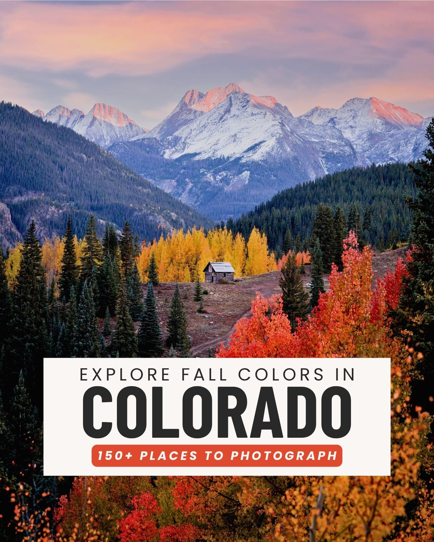
Best Scenic Drives for Fall Colors in Colorado (2026)
Find the best scenic drives for fall colors in Colorado with peak timing, road conditions, vehicle tips, and photos from my favorite drives across the state.


One of the best things about fall in Colorado is that you don't have to hike to see incredible color. Some of the state's biggest aspen groves are right along scenic highways and mountain passes, making a fall road trip one of my favorite ways to see the changing colors.
📌 Related Blog Posts To Save For Later
What Kind of Vehicle Do You Need?
For most Colorado fall trips, you do not need a 4WD vehicle. Many of the best fall color drives are paved or generally accessible with a regular passenger vehicle when conditions are good.
Keep in mind that Colorado can get its first mountain snow by late September or early October. It's often limited to the highest elevations, but snow can reach roads around 9,000 feet or lower. If you're visiting later in the season, check both the weather and current road conditions before heading into the mountains.
Regular Passenger Vehicle / 2WD
- Million Dollar Highway
- Independence Pass
- Guanella Pass
- Kenosha Pass
- Tennessee Pass
- Peak to Peak Scenic Byway
- Grand Mesa Scenic Byway
- Kebler Pass*
- Ohio Pass*
- Owl Creek Pass*
*These roads are unpaved but are generally manageable in a regular passenger vehicle when dry and in good condition. Always check current conditions first.
High Clearance + 4WD Capability Recommended
- Last Dollar Road
- Capitol Creek Trailhead
- Crystal Mill
- Ophir Pass
- Buffalo Pass
For these roads, clearance is usually my biggest concern. I rarely actually need to use 4WD, but if conditions are wet, muddy or questionable, I want the capability to have it.
If you're renting a car, don't assume you need a Jeep or large SUV. Decide what you actually want to drive first, then choose your rental based on those roads. Most visitors will be perfectly fine with a regular passenger vehicle. For unpaved mountain roads, always check current conditions and never rely solely on Google Maps to determine whether a road is appropriate for your vehicle.
Check Mountain Weather + Road Conditions Before You Go
Weather in Colorado's mountains can change quickly, and conditions at the top of a mountain pass can be completely different from the nearest town, as these can differ by thousands of feet of elevation. This is especially important during fall, when high-elevation roads can see their first snow while it's still warmer and sunny at lower elevations.
Before heading out, I recommend checking the National Weather Service forecast for the actual mountain pass, not just the nearest town. Doing a point forecasts give you weather for a specific location and elevation, which can give you a much better idea of what conditions will actually be like on the pass. I also use COtrip to check current road conditions, closures, alerts, traction laws, and road cameras.
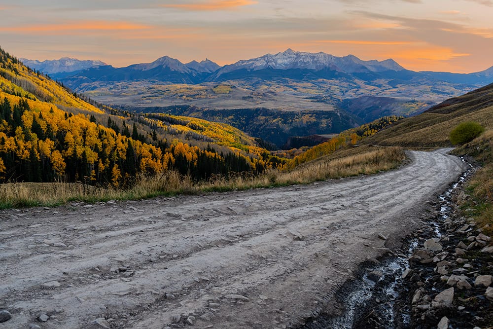
23 of the Best Scenic Drives for Fall Colors in Colorado
I've included my favorite fall drives across Colorado below, along with mileage and road conditions so you know what you're getting into. Many are completely paved and doable in any passenger vehicle, while others include dirt roads or may require higher clearance depending on conditions.
Keep in mind: Road conditions can change quickly in the mountains, especially after rain or early-season snow. Always check current conditions before heading onto unpaved mountain roads. If you're going on a weekend day trip from Denver, GO EARLY. These drives can get extremely busy with bumper to bumper traffic. The closer to Denver they are, the busier they will be so plan ahead and go early.
Front Range
- Peak to Peak Scenic Byway — Estes Park to Black Hawk | 55 miles | Paved | Typical Peak: Mid to late September
- Guanella Pass Scenic Byway — Georgetown to Grant | 22 miles | Paved | Typical Peak: Mid to late September
- Kenosha Pass — Grant to Jefferson | ~18 miles | Paved | Typical Peak: Mid to late September
- Trail Ridge Road — Estes Park to Grand Lake | 48 miles | Paved | Typical Peak: Mid to late September | Fee Required, Entry to RMNP
- Boreas Pass Road — Breckenridge to Como | ~22 miles | Paved → dirt/gravel | 2WD generally fine when dry | Typical Peak: Mid to late September
- Berthoud Pass — Empire to Winter Park | ~25 miles | Paved | Typical Peak: Mid to late September
Central Mountains
- Collegiate Peaks Scenic Byway — Salida to Granite via Buena Vista | 57 miles | Paved | Typical Peak: Late September
- Independence Pass — Twin Lakes to Aspen | ~44 miles | Paved | Typical Peak: Late September
- Castle Creek Road — Aspen to Ashcroft | ~13 miles one way | Paved → dirt | 2WD generally fine when dry | Typical Peak: Late September
- McClure Pass — Carbondale to Paonia | ~47 miles | Paved | Typical Peak: Late September to early October
- Kebler Pass — Crested Butte to Highway 133 | ~30 miles | Mostly dirt/gravel | 2WD generally fine when dry | Typical Peak: Early October (West Side)
- Ohio Pass — Crested Butte/Gunnison area | ~20 miles | Dirt/gravel | 2WD generally fine when dry | Typical Peak: Early October
- West Elk Loop Scenic Byway — Carbondale → Paonia → Gunnison → Crested Butte → Carbondale | 205 miles | Paved except Kebler Pass section | Typical Peak: Late September to early October
- Tennessee Pass — Leadville to Minturn | ~36 miles | Paved | Typical Peak: Late September
- Buffalo Pass — Steamboat Springs toward North Park/Walden | ~45 miles for the full route | Paved → dirt/rough gravel | High clearance recommended for full route | Typical Peak: Mid to late September
Southwest Colorado
- Last Dollar Road — Telluride area to Dallas Divide | ~21 miles | Dirt | High clearance and all-terrain tires recommended; 4WD preferred when wet | Typical Peak: Early October
- Dallas Divide / CO-62 — Ridgway toward Placerville | ~23 miles | Paved | Typical Peak: Early October
- CO-145 / San Juan Skyway — Telluride → Rico → Dolores | ~65 miles | Paved | Typical Peak: Early October
- Million Dollar Highway — Silverton to Ouray | 25 miles | Paved | Typical Peak: Late September to Early October (Late September 90% of the time with some years extending to October 1-4ish)
- Owl Creek Pass — Ridgway to Highway 50/Cimarron area | ~42 miles | Dirt/gravel | 2WD generally fine when dry | Typical Peak: Early October
- Silver Thread Scenic Byway — South Fork to Lake City | ~75 miles | Paved | Typical Peak: Mid to Late September
Western Colorado
- Grand Mesa Scenic Byway — Cedaredge to I-70 via Grand Mesa | 63 miles | Paved | Typical Peak: Late September
- Divide Road — Unaweep Canyon/Whitewater toward Divide Forks | ~30–40 miles depending on route | Mostly dirt/gravel | Typical Peak: Late September to early October
My Favorite Colorado Fall Drives
I've driven all over Colorado looking for the best fall drives, but there are a handful I come back to every year. If you're trying to narrow down the list above, these are some of my personal favorites I drive year after year. If you're wondering if I'm biased to the west slope, yes, yes I am. I also live over here making it extra convenient, but I do truly think they are the most scenic fall drives in Colorado.
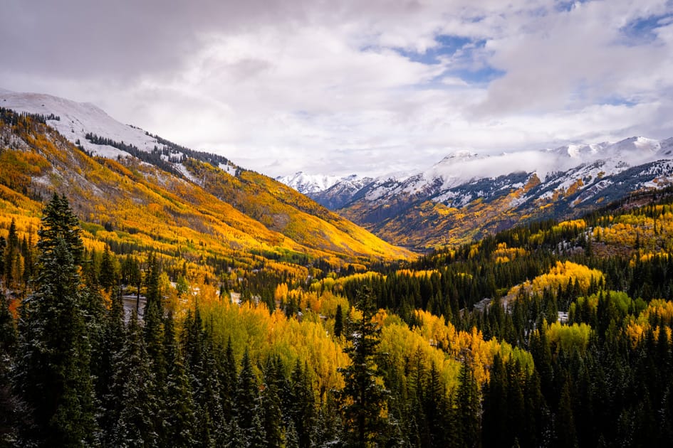
Million Dollar Highway
If I could only choose one fall drive in Colorado, the Million Dollar Highway would be hard to beat. The 25-mile stretch of Highway 550 between Silverton and Ouray is incredible any time of year, but add golden aspens to the San Juan Mountains and it's easily one of my favorite drives in the state.
MY PRO TIP. It may only be 25 miles, but I would give yourself at least two hours during fall so you have plenty of time to stop at the overlooks and take photos. If you can go with someone, take turns driving so you can both enjoy the scenery, and be sure to drive it in both directions (North and South) to really get the full experience.
If you only stop for ONE photo (which I recommend way more than this) you have to take a picture HERE. Park HERE and safely walk along the road to see the incredible aspen grove over Red Mountain Pass. The image just above is from this spot.
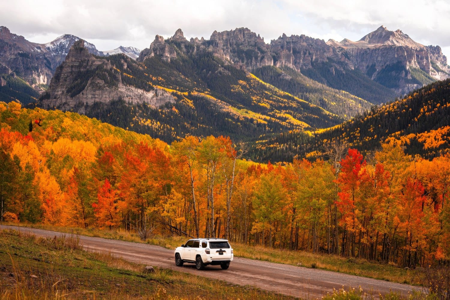
Owl Creek Pass
Owl Creek Pass is one of my favorite alternatives to the busier paved roads around Ridgway and Ouray. The drive takes you through huge aspen groves with incredible views of the Cimarron Mountains, and the scenery feels completely different from nearby Dallas Divide and the Million Dollar Highway. Don't stop before you get to Silverjack Reservoir - the view towards the Cimarrons from Silverjack is my favorite on the drive. (the photo immediately above)
The road is unpaved, but when it's dry and in good condition, it's generally manageable in a regular passenger vehicle. Conditions can change quickly after rain or snow, so this is definitely one to check before you go. Another bonus for going here? It usually peaks between October 1-14 and most visitors have gone home so traffic is usually just locals.
Despite closing for the Gold Mountain Fire, Owl Creek officially reopened on September 15, 2026 making it an option for your fall colors road trip in 2026.
Read the official announcement here: Owl Creek Pass Will Be OPEN for Fall Colors 2026
Highway 145
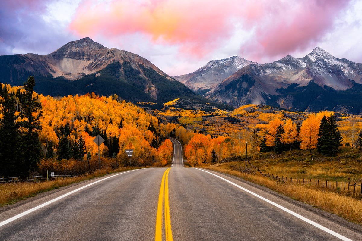
The stretch of Highway 145 south of Telluride is my favorite in the area. From Telluride, you can follow the highway toward Lizard Head Pass and Rico through huge stretches of aspens with views of the surrounding peaks.
This is also an easy drive to combine with Dallas Divide, Last Dollar Road, or the Telluride gondola if you're spending a full day chasing fall colors in the area.
MY PRO TIP: Turn around once you get to Lizard Head Pass. It's mostly evergreen past that unless you plan to go to Rico and south. I prefer to turn around at the pass and enjoy the section between Mountain Village and Lizard Head Pass.
Grand Mesa Scenic Byway
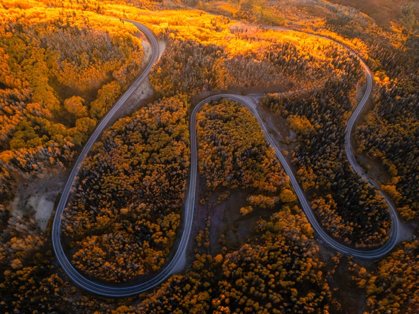
The Grand Mesa doesn't get nearly as much attention as Aspen, Telluride, or Crested Butte, but it's one of my favorite places for fall colors on the Western Slope. The mesa is covered in huge aspen forests, and because the road changes elevation as it crosses the mountain, you can often find different stages of color along the same drive. The lower aspens near Powderhorn Ski Resort on the side of the Mesa always turn last, while the groves up top near Mesa Lakes are usually first. Don't be disappointed if things look green at the bottom.
The entire scenic byway is paved, making this one of the easiest drives on this list if you want incredible fall color without worrying about dirt mountain roads.
MY PRO TIP: I prefer driving east from Powderhorn up to County Line then turn around. The section between County Line and Cedaredge is mostly evergreens.
Kebler Pass
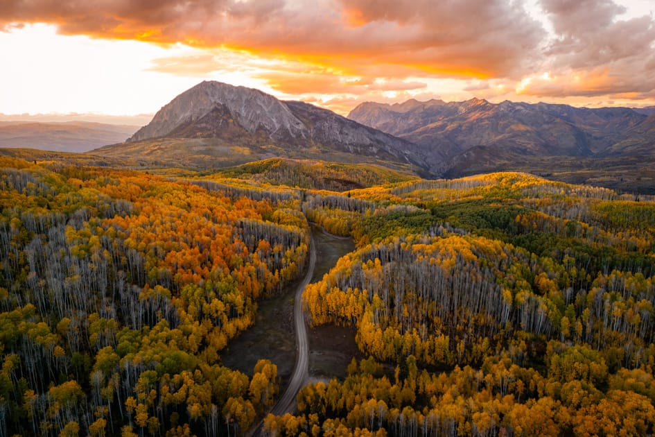
If your goal is simply lots of aspens everywhere, put Kebler Pass high on your list. The road west of Crested Butte travels through enormous aspen groves, with sections where it feels like you're completely surrounded by gold. It's part of the larger West Elk Loop and is consistently one of my favorite fall drives in Colorado. In fact, I'd put this in my top two favorite right up there with the Million Dollar Highway.
Most of Kebler is dirt/gravel, but it's generally an easy drive in a regular passenger vehicle when the road is dry and in good condition. Give yourself plenty of time for stops because there are beautiful views basically the entire way. I would budget at least 2 hours for the drive itself to account for stops.
Tennessee Pass
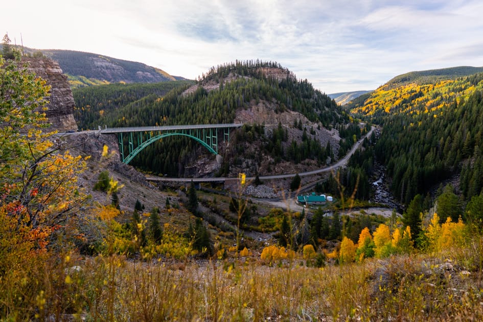
Tennessee Pass doesn't get nearly as much attention as some of Colorado's more famous fall drives, which is part of why I love it. The drive between Leadville and Minturn (Highway 24) is completely paved and takes you through high-elevation forests and large stretches of aspens without requiring any complicated mountain-road driving. Don't miss stopping to see the Red Cliff Bridge along the way. Built in 1941, it stretches more than 470 feet across a nearly 200-foot-deep gorge over the Eagle River and is honestly just really cool to see in person, especially surrounded by fall colors. Weird PSA - but watch out for rattlesnakes if you go romping through tall brush off the side of the road. I saw one along here last year and was very caught off guard.
It's really easy to combine with Leadville, Twin Lakes, or Vail if you're building a larger Central Colorado fall road trip.
Independence Pass
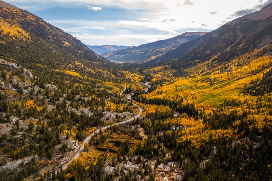
Independence Pass is one of those drives that's spectacular even without fall color. Highway 82 connects Twin Lakes and Aspen, climbing to 12,095 feet at the Continental Divide before dropping into the Roaring Fork Valley. During fall, the lower portions of the drive are lined with aspens on both sides of the drive while the higher elevations give you huge mountain views.
The road gets narrow in places, particularly on the Aspen side, and there are sections where traffic essentially has to take turns. Take your time, watch for cyclists, and don't try to rush, especially on the Aspen side.
Castle Creek Road
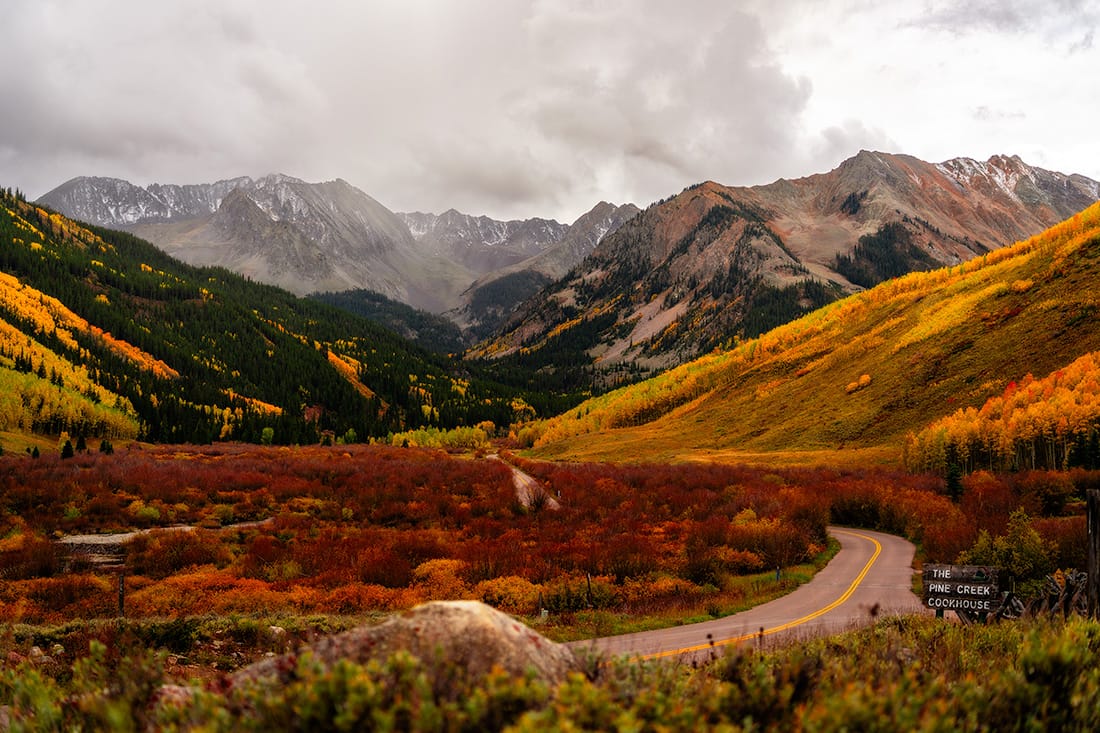
Castle Creek Road is one of my favorite fall drives around Aspen, especially if you want something quieter than Maroon Bells. The road follows Castle Creek south from Aspen toward Ashcroft, and it's such a beautiful drive the entire way. This is usually one of the first areas to turn in the Aspen area, so if you're early, prioritize this one.
Make time to stop at Ashcroft Ghost Town, and if you're comfortable continuing beyond the paved portion, the scenery farther up Castle Creek is gorgeous during fall. High clearance and 4WD are recommended to continue on this portion. This is an easy drive to pair with Independence Pass if you're spending a full day exploring around Aspen. At least drive to the Pine Creek Cookhouse (paved the entire way) because I love the view looking back towards Star Peak. That's the view right above this.
Colorado Fall Color Drives FAQ
When is the best time to drive Colorado’s scenic roads for fall colors?
Generally, mid-September through early October, but timing varies by elevation and location. Higher-elevation and northern areas usually change first, while lower elevations and parts of southwest Colorado can peak into early October. Choose your drive based on when you plan on visiting to maximize peak colors.
What is the best scenic drive for fall colors in Colorado?
There really isn’t just one! The options are limitless. Some of my personal favorites are the Million Dollar Highway, Owl Creek Pass, Highway 145, Grand Mesa Scenic Byway, Kebler Pass, Tennessee Pass, Independence Pass, and Castle Creek Road. Yes, I'm partial to the west slope.
Do I need 4WD for Colorado fall color drives?
For most of them, no. Many of Colorado’s best fall drives are completely paved. Some unpaved roads, including Kebler Pass and Owl Creek Pass, are generally manageable in a regular passenger vehicle when dry and in good condition. Roads like Last Dollar Road and Buffalo Pass are better suited for higher-clearance vehicles or at least have all terrain tires.
Are Colorado’s scenic fall drives scary or dangerous?
Most aren't. However, some mountain roads have steep grades, switchbacks, narrow sections, or exposed drop-offs. Million Dollar Highway and Independence Pass are two to research ahead of time if you're uncomfortable with mountain driving and heights. Keep your eyes on the road to watch for other vehicles, stay in your lane, and go the speed limit and you'll be fine.
What is the best fall color drive near Denver?
Guanella Pass, Peak to Peak Scenic Byway, Kenosha Pass, and Boreas Pass are all good options from Denver. They're also extremely popular during peak fall color, especially on weekends, so plan to go early.
How early should I start a fall color drive?
On peak weekends, GO EARLY. Roads near Denver and popular destinations like Aspen, Crested Butte, and the San Juans can get extremely busy, but typically the closer you are to Denver, the busier it will be. Weekdays are even better if your schedule allows.
How long should I plan for a scenic fall drive?
Much longer than Google Maps says. A drive that takes an hour without stopping can easily take two or three hours during fall once you add overlooks, photos, short hikes, and traffic.
Can it snow during a Colorado fall road trip?
Absolutely. We can get snow all 12 months throughout the year here, but high-elevation roads can see the first snow of winter as early as September. Always check the weather and current road conditions before heading over a mountain pass, especially later in September and early October. It's not uncommon to get our first snow by October, so if you're visiting later in the season, be prepared. Check the weather for the actual passes and not just closest town, as the elevation difference can be significant.
Are Colorado's fall color drives free?
Most scenic drives on this list are free to drive. Trail Ridge Road requires entrance to Rocky Mountain National Park, but the others are free.
Can I see several scenic drives in one day?
Sometimes, but I wouldn't try to cram too many together. Colorado distances can be deceiving, and you'll want time to actually stop and enjoy the color. I would choose one main drive and build the rest of the day around it rather than spending the entire day in the car. If you do want to combine a few drives in one day, I'd recommend Independence Pass + Castle Creek Road, Owl Creek Pass + Dallas Divide + Highway 145, Last Dollar Road + Dallas Divide, Guanella + Kenosha (leave early for this)
Where can I check the weather for mountain roads and passes?
Use the National Weather Service Point Forecast for the actual mountain pass rather than the nearest town. I also recommend checking COtrip for current road conditions, closures, and road cameras before you go.
Final Thoughts
...From Someone Who Plans Their Life Around Fall Colors:
Literally though. I LIVE for fall colors in Colorado. I take time off work for 2-3 weeks every single year for fall—and it’s always the same weeks. Because they work consistently. If you give yourself flexibility and understand how the timing actually works, you won’t miss it. So if you only take away ONE thing from this entire website:
Visit the last week of September or first week of October You’ll hit peak somewhere in Colorado—just be willing to be flexible and adjust location.
Planning a photography trip to Colorado for fall colors?
If you want exact locations, drives, and photo spots already mapped out (with time of day to shoot them): Check out my Colorado Fall Colors Guide. You can even download the guide in the app for offline access, so you'll always have it with you—even when you don't have cell service in the mountains. And be sure to join my Fall Colors Channel on Instagram where I update live color changes on the West Slope.
See you out there!
Mallory